


Molokai Geography
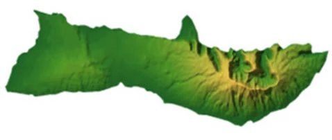
Molokai's geography is defined by dramatic natural contrasts - towering sea cliffs on the north shore, an expansive barrier reef to the south, and two massive volcanoes that formed the island: East Molokai (Wailau) and West Molokai (Mauna Loa). The island's highest peak, Kamakou, rises to 4,961 feet. Once part of the larger landmass Maui Nui, Molokai offers visitors a glimpse into prehistoric geological forces and untouched Hawaiian landscapes.
Molokai is the fifth largest of the six main Hawaiian islands (only the island of Lanai is smaller) encompassing 260.0 square miles (673.4 km²). At its longest points the island measures 10 miles (16 km) from north to south and 38 miles (61 km) from east to west, with a total shoreline of 88 miles (142 km).
Molokai is made up of two shield volcanoes – East Molokai (also known as Wailau) and West Molokai (also known as Mauna Loa). Molokai's highest peak is Kamakou, which is part of the East Molokai Volcano, rising 4,961 feet (1,512 m).
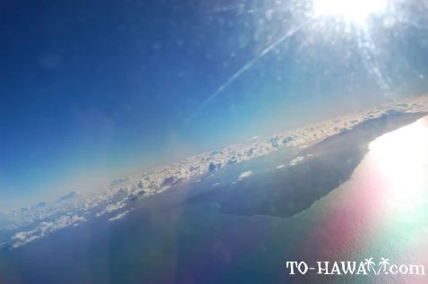
East Molokai Volcano used to be much larger in the past. About 1.5 million years ago, it experienced what is known as a catastrophic collapse, where its northern portion broke off and slid to the bottom of the ocean. Today, only the volcanoes southern half remains standing. What remains above the ocean's surface on the island's north shore are the tallest sea cliffs in the world, dropping 3,315 feet (1,010 m) to the Pacific Ocean. Molokai's south shore has the longest fringing reef in the United States, measuring almost 25 miles (40 km) in length.
The largest town on Molokai is Kaunakakai, located on the island's south shore. It has a population of 3,425 (the total population on Molokai is 7,345). Molokai is part of Maui County, which also includes the islands of Maui, Lanai and Kahoolawe.
Molokai's tallest mountains:
| Mountain | Feet | Meters |
| Kamakou | 4,961 | 1,512 |
| East Molokai (Wailau) | 3,970 | 1,210 |
| West Molokai (Mauna Loa) | 1,381 | 421 |
About 20,000 years ago Molokai was joined together with the neighbor islands of Maui, Lanai and Kahoolawe. It was one big island referred to as Maui Nui, meaning Big Maui. There was a mini ice age at this time which caused the sea level to drop. As the islands eroded and the sea level rose, Maui Nui became what is now four separate islands. The ocean channels between these four islands are relatively shallow.
Frequently Asked Questions about Molokai Geography
What volcanoes formed Molokai?
Molokai was formed by two shield volcanoes - East Molokai (Wailau) and West Molokai (Mauna Loa). East Molokai is the larger of the two and home to the island's tallest peak, Kamakou.
How large is Molokai?
Molokai covers approximately 260 square miles and measures 38 miles long and 10 miles wide at its broadest points.
Are the sea cliffs really the tallest in the world?
Yes. Molokai's northern sea cliffs reach heights over 3,000 feet, making them the tallest sea cliffs in the world.
What is special about the south shore?
Molokai's south shore has the longest fringing reef in the U.S., stretching nearly 25 miles and protecting an extensive marine ecosystem.