


Ma'ili
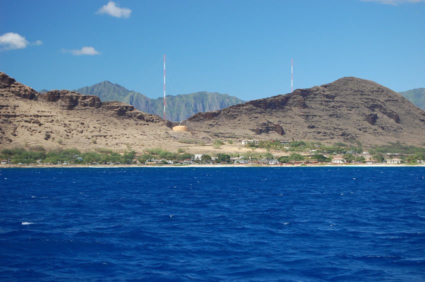
Ma'ili is a quiet coastal community located on Oahu's leeward (west) shore between Nanakuli and Wai'anae. Known for its long stretch of white-sand beach and peaceful setting, Ma'ili is a place where locals gather to fish, surf, and enjoy the ocean. The area is also home to a major U.S. Navy communications facility with towering masts visible from afar.
Ma'ili, Oahu
Ma'ili (view panorama) × is a small community on Oahu's leeward coast, located between Nanakuli and Wai'anae. It has a nice long white-sand beach, Ma'ili Beach Park. In the Hawaiian language, ma'ili means "pebbly," referring to the shoreline's rounded stones.
Located in Ma'ili is the Naval Radio Transmitter Facility Lualualei (NRTF Lualualei). The two tallest masts are 1,503 feet (458 m) tall. When they were built in 1972, they were the tallest man-made structure in the Western Hemisphere at the time.
The facility is used to transmit high and low frequency radio signals to communicate with Navy vessels including submarines throughout the Pacific. Both the Navy and the Coast Guard use this facility.
Key Features of Ma'ili
- Leeward coast community: Located between Nanakuli and Wai'anae, offering open beaches and scenic coastal views.
- Ma'ili Beach Park: A long white-sand beach with space for picnics, camping, fishing, and surfing.
- Military facility: Home to the Naval Radio Transmitter Facility Lualualei, once the tallest structure in the Western Hemisphere.
- Hawaiian name origin: “Ma'ili” means “pebbly,” referring to the shoreline's natural stone features.
- Population: 11,535 (2020 Census)
- Zip code: 96792


Frequently Asked Questions
Is Ma'ili Beach good for swimming?
Ma'ili Beach is more popular for fishing and surfing due to strong currents and shorebreak; swimming is best with caution.
Where is Ma'ili located?
Ma'ili is on Oahu's west coast between the towns of Nanakuli and Wai'anae, along Farrington Highway.
What is the tall structure near Ma'ili?
The Naval Radio Transmitter Facility Lualualei has 1,503-foot towers used for military communication throughout the Pacific.
Can you camp at Ma'ili Beach Park?
Yes, locals often camp at the beach park on weekends, but permits are required from the City & County of Honolulu.
What is the best time to visit Ma'ili?
Mornings and late afternoons are ideal to avoid the heat. The sunsets at Ma'ili Beach are especially beautiful and popular with photographers.