
Oahu Geography Guide
Oahu Geography
Explore Oahu's mountain ranges, valleys, coastal plains, volcanic landmarks and island regions, from the Wai'anae Range to the lush Ko'olau windward coast.
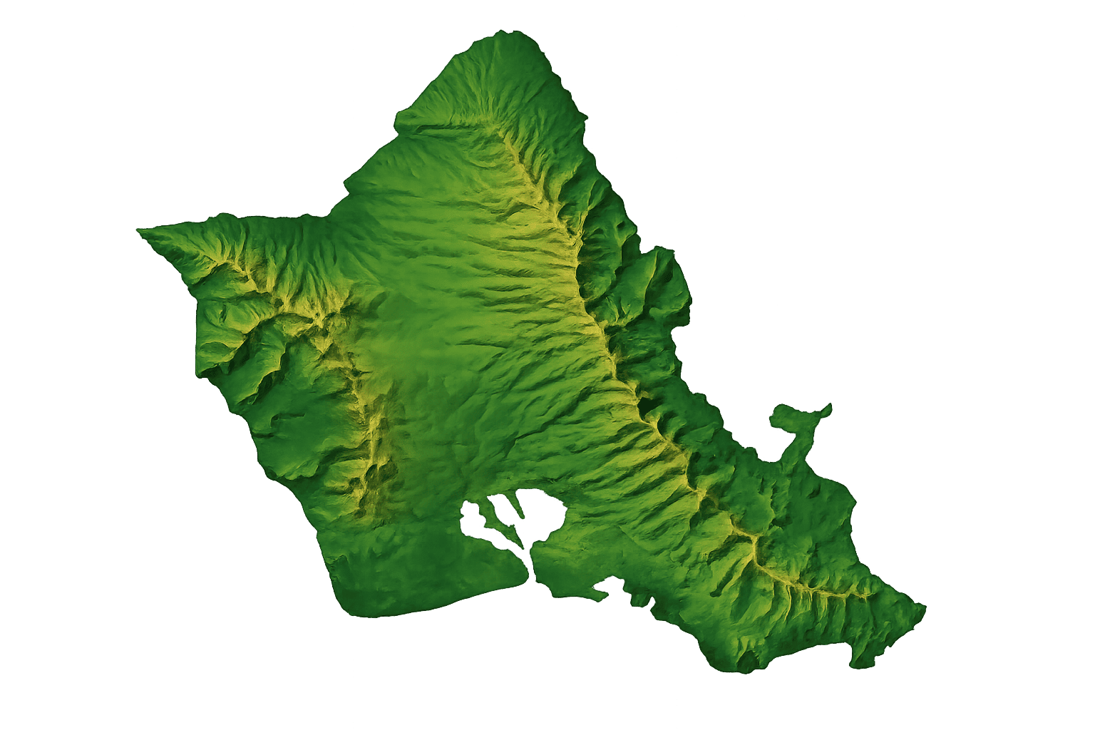
Oahu is the third largest of the main Hawaiian Islands, after Hawaii's Big Island and Maui, encompassing 596.7 square miles (1,545.4 km2). It measures 44 miles (71 km) from north to south and 30 miles (48 km) from east to west, with a total shoreline of 227 miles (365 km). The island is made up of two now extinct shield volcanoes, Waianae in the western part of the island and Koolau in the east. In between lies the Central Oahu Plain, a broad valley. The highest mountain on Oahu is Mt. Kaala, located in the Waianae Mountain Range, rising to 4,003 feet (1,220 m) above sea level.
Oahu Volcanoes and Mountain Ranges
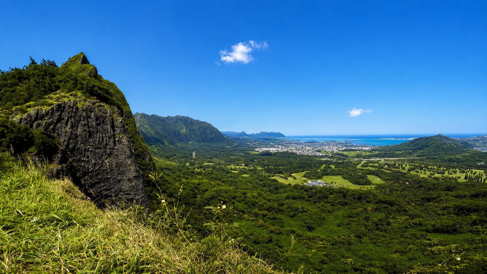
The Waianae Mountain Range is the oldest part of Oahu at about four million years old. It is believed that Oahu originated at Lualualei Valley. This is the dry side of the island. The Koolau Mountain Range, located on the windward coast, faces the tradewinds, which bring moisture with them. This side of Oahu is green and lush with rainforests and waterfalls.
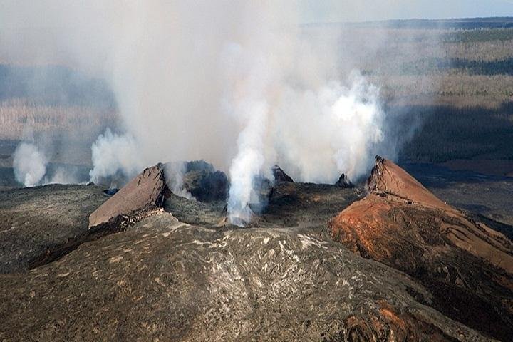
Besides these two main mountain ranges, there are a few smaller volcanic mountains on the island, all of which are extinct as well. The most popular such volcanic cone is Diamond Head, located at the east end of Waikiki. Two other ones are Punchbowl and Koko Head. The Koko Head area, on Oahu's southeast side, is the youngest part of the island at about 32,000 years old.
Oahu Mountains
The chart below shows other Oahu mountains:
| Mountain | Feet | Meters |
|---|---|---|
| Kaala | 4,003 | 1,220 |
| Puu Kalena | 3,504 | 1,068 |
| Konahuanui | 3,150 | 960 |
| Tantalus | 2,013 | 614 |
| Olomana | 1,643 | 501 |
| Koko Crater | 1,208 | 368 |
| Nuuanu Pali Lookout | 1,186 | 361 |
| Diamond Head | 760 | 232 |
| Koko Head | 642 | 196 |
| Punchbowl | 500 | 152 |
Oahu Regions
The southern part of the island, the metro Honolulu area, is the most populated. Local residents refer to this area as “town,” while the rest of the island is called the “country.” Oahu is separated into five main regions: Honolulu, including Waikiki, the windward coast, the leeward coast, the North Shore and Central Oahu.

Frequently Asked Questions
What are the main mountain ranges on Oahu?
Oahu has two main mountain ranges: the Wai'anae Range on the west side and the Ko'olau Range on the east side. Both ranges formed from ancient shield volcanoes.
What is the highest point on Oahu?
Mount Ka'ala is the highest point on Oahu. It rises 4,003 feet, or 1,220 meters, in the Wai'anae Range on the island's west side.
Why is the east side of Oahu greener than the west side?
The Ko'olau Range faces the trade winds, which bring moisture from the ocean. As the air rises over the mountains, it produces more rain on the windward side, while the leeward side stays drier.
Is Diamond Head an active volcano?
No. Diamond Head is an extinct volcanic cone near Waikiki. It no longer erupts and now serves as one of Oahu's most famous hiking and sightseeing landmarks.
How large is Oahu?
Oahu covers about 596.7 square miles. The island measures roughly 44 miles from north to south and 30 miles from east to west, with about 227 miles of shoreline.