

Kauai Geography Guide
Kauai Geography
Explore Kauai geography, from Mount Waialeale and Kawaikini to the Na Pali Coast, Waimea Canyon, lush valleys, sea cliffs and windward rainfall patterns.
Kauai is the oldest of the main Hawaiian Islands and one of the most deeply eroded. Over time, rain, streams, wind and waves have carved the island into green valleys, rugged ridges, dramatic sea cliffs and one of Hawaii's most famous canyons.
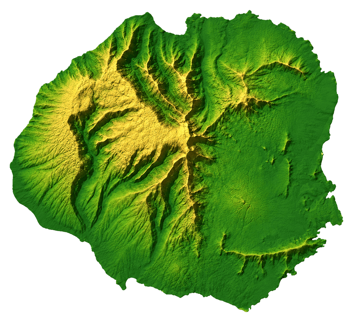
The island covers about 552 square miles and has a roughly circular shape, with high mountains near the center and coastal communities around the island. Kauai's geography is one of the main reasons it looks so lush compared with many other Hawaiian landscapes.
An Old Volcanic Island Shaped by Erosion
Like the other Hawaiian Islands, Kauai was formed by volcanic activity. But because Kauai is older than the other main islands, erosion has had much more time to shape its mountains and valleys.
Instead of a single broad active volcano, Kauai now has deeply cut ridges, waterfalls, stream valleys and cliffs. The island's old volcanic core still rises in the interior, while the coast shows how waves and rainfall continue to reshape the island.
Kauai's Major Summits
The chart below shows several of Kauai's best-known mountains and landmarks by elevation:
| Mountain or Landmark | Feet | Meters |
|---|---|---|
| Kawaikini | 5,243 | 1,598 |
| Mount Waialeale | 5,148 | 1,569 |
| Nounou Mountain | 1,241 | 378 |
Mount Waialeale and Kauai's Rainfall
Mount Waialeale is one of Kauai's most famous geographic features. The mountain area receives a large amount of rainfall because moist trade winds rise over the island's central highlands and release rain.
This rain feeds streams, waterfalls and valleys across the island. It also explains why Kauai has such a green appearance and why the island is often called the Garden Isle.
Waimea Canyon
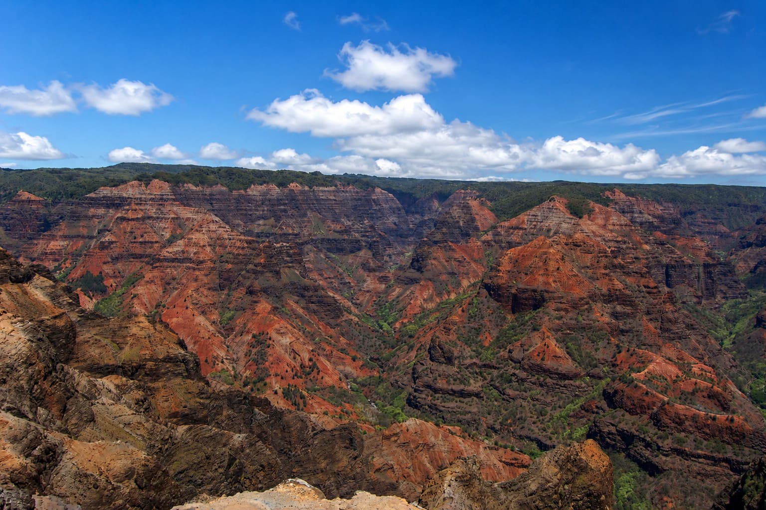
Waimea Canyon State Park is one of Kauai's most dramatic inland landscapes. It stretches across the island's west side and shows layers of red, brown and green volcanic rock cut by erosion over time.
The canyon was shaped by rainfall, streams and the long erosion of Kauai's old volcanic terrain. Visitors can see the canyon from roadside lookouts, hiking trails and viewpoints in the Waimea Canyon and Kokee areas.
The Na Pali Coast
Na Pali Coast State Park is one of Kauai's most famous coastal regions. It is known for tall sea cliffs, narrow valleys, waterfalls and rugged shoreline along the island's northwest side.
Much of this coast is remote and cannot be reached by regular road. Visitors usually see it by boat, air tour or hiking the Kalalau Trail when conditions and access allow. The steep cliffs show how strongly waves, rain and streams have carved Kauai's old volcanic slopes.
Windward and Leeward Kauai
Kauai's north and east sides are generally wetter because they face the trade winds. These windward areas receive more frequent showers, especially near the mountains and valleys.
The south and west sides are usually drier because they sit more in the rain shadow of the island's mountains. This contrast helps explain why places like Poipu often feel sunnier, while the north shore and interior highlands look greener and wetter.
How Kauai's Geography Shapes a Visit
Kauai's geography affects almost every part of a trip. The island's mountains can create sudden clouds and showers, while the coast may be sunny at the same time. Roads also follow the island's edges because the rugged interior is difficult to cross.
For lush scenery and waterfalls, the north shore, east side and interior valleys are especially scenic. For canyon views and drier landscapes, the west side around Waimea and Kokee State Park offers a very different side of Kauai. For beach weather, many visitors look to the south shore, where conditions are often sunnier.
Kauai may be smaller than Maui or the Big Island, but its geography is dramatic. Old volcanic mountains, heavy rainfall, deep valleys, sea cliffs, canyons and beaches all fit into one island landscape.


Frequently Asked Questions
What is Kauai known for geographically?
Kauai is known for its old volcanic landscape, deeply eroded valleys, tall sea cliffs, Waimea Canyon, lush mountains, waterfalls and green windward scenery.
What is the highest point on Kauai?
Kawaikini is the highest point on Kauai at about 5,243 feet, or 1,598 meters. It sits near Mount Waialeale in the island's wet central highlands.
Why is Kauai so green?
Kauai's mountains catch moist trade winds, especially near Mount Waialeale. This rainfall feeds streams, waterfalls and valleys and gives the island its lush Garden Isle scenery.
How was Waimea Canyon formed?
Waimea Canyon was shaped by erosion, rainfall, streams and volcanic geology over a long period of time. The result is one of Kauai's most dramatic inland landscapes.
What makes the Na Pali Coast unique?
The Na Pali Coast is famous for steep sea cliffs, narrow valleys, waterfalls and rugged coastline. Much of it is remote and can only be seen by trail, boat or air.