

Big Island Geography Guide
Big Island Geography
Explore Big Island geography, from Hawaii's largest landmass and tallest mountains to five volcanoes, lava zones, elevation changes and active volcanic landscapes.
The Big Island of Hawaii is the largest of all the Hawaiian Islands. In fact, the land areas of Oahu, Maui, Kauai, Molokai, Lanai, Niihau and Kahoolawe all fit into the Big Island's land area with room left over. The map below is approximate and not to scale, but it gives you an idea of the islands' size in relation to each other.
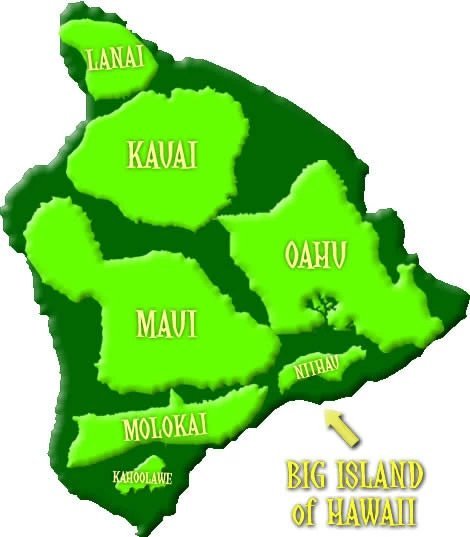
The Big Island encompasses 4,028 square miles, or 10,432.5 square kilometers. It measures about 93 miles across and makes up about 62 percent of the Hawaiian Islands' total land area. But its large size is not the only thing that makes this island stand out. The Big Island is also home to Hawaii's tallest mountains and some of the state's most dramatic volcanic landscapes.
Big Island Mountains and Elevation
The chart below shows several of the Big Island's highest mountains and volcanic summits:
| Mountain | Feet | Meters |
|---|---|---|
| Mauna Kea | 13,796 | 4,205 |
| Mauna Loa | 13,679 | 4,169 |
| Hualalai | 8,271 | 2,521 |
| Kohala | 5,480 | 1,670 |
| Kaumu o Kaleihoohie | 5,252 | 1,601 |
| Kilauea | 4,091 | 1,247 |
The Big Island's Five Volcanoes
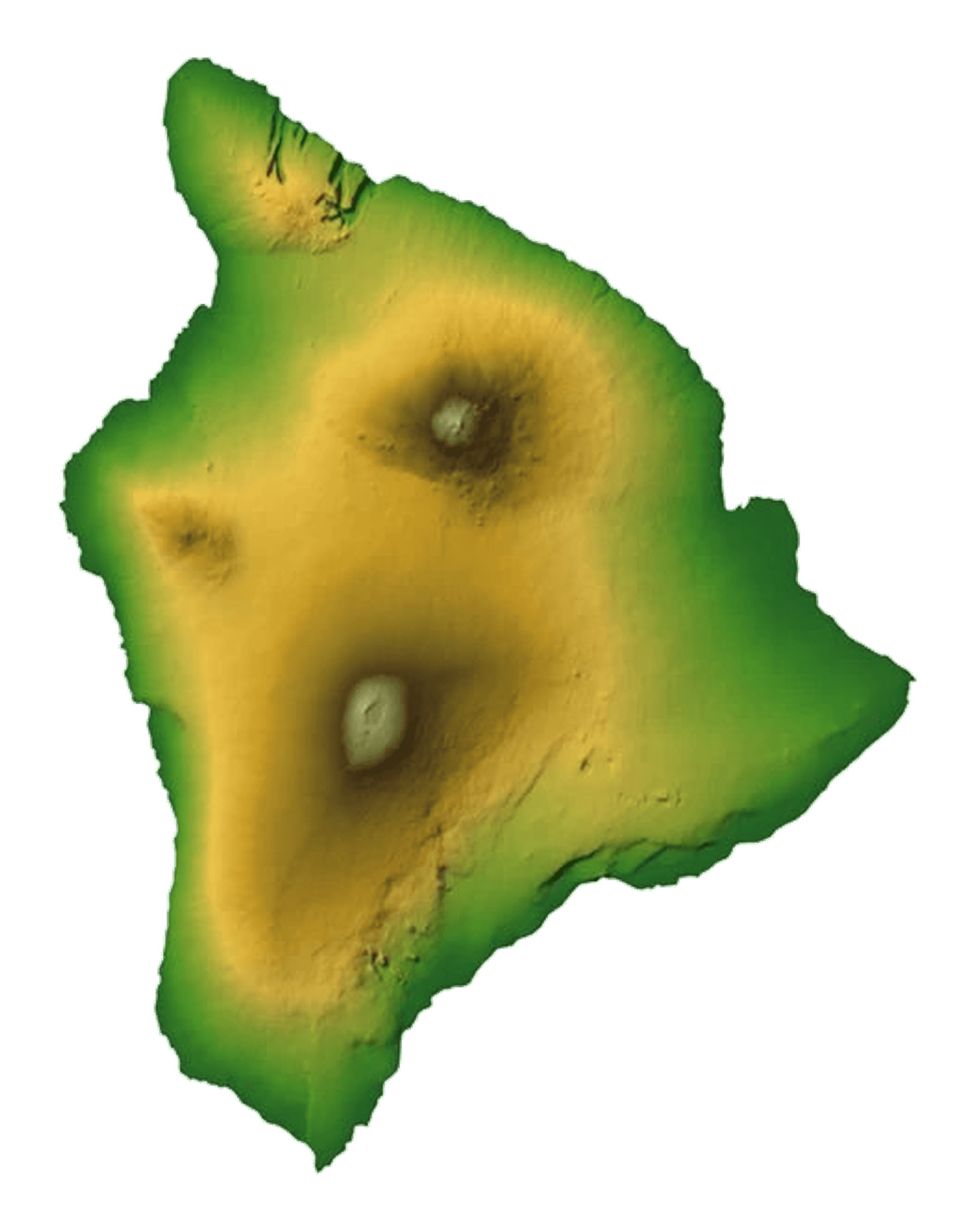
The Big Island of Hawaii was built from five volcanoes: Mauna Kea, Mauna Loa, Hualalai, Kohala and Kilauea. Each one helped shape the island's landmass, slopes, districts and coastlines. Together, they explain why the island is so large and why its geography changes so much from one region to another.
Mauna Kea is slightly higher than Mauna Loa when measured from sea level. When measured from the ocean floor to its summit, Mauna Kea is one of the tallest mountains in the world. The summit area is high, cold and very different from the warm coastal areas below.
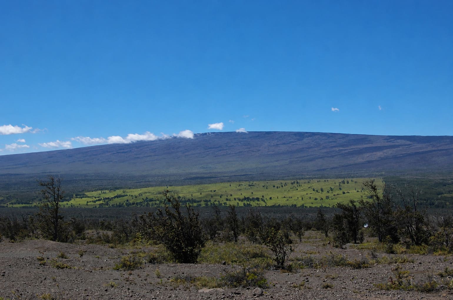
Mauna Loa is one of the largest shield volcanoes on Earth by volume and area. It rises 13,679 feet above sea level and extends far below the ocean surface. Its long, broad slopes cover a large part of the island and help shape the island's southern and central terrain.
Kohala, in the northern part of the Big Island, is the oldest of the island's five volcanoes and is now extinct. Mauna Kea and Hualalai are older than Kilauea and Mauna Loa and are considered dormant. Kilauea and Mauna Loa are the youngest and most active volcanoes on the island.
Volcanic Landscapes and Hawaii Volcanoes National Park
Hawaii Volcanoes National Park is the main place where visitors can learn about the Big Island's volcanic geography. The park includes volcanic craters, lava fields, rainforest, steam vents, high-elevation areas and sections of Mauna Loa and Kilauea.
Volcanic activity changes over time, and different areas may open, close or change based on safety conditions. Visitors planning to explore volcano areas should check current park information before going and respect all closures, signs and safety guidance.
Lava Zones and Living on an Active Island
Because the Big Island is still volcanically active, lava hazards are an important part of its geography. Some areas, especially in parts of Puna and Ka'u, have a higher lava risk than other parts of the island. These differences matter for residents, landowners and visitors who want to understand the island's changing landscape.
The island's lava fields, black-rock coastlines, cinder cones and volcanic slopes all show how young the Big Island is compared with the older Hawaiian Islands. In some areas, the land looks dry and raw. In others, rainforest and new plant life have begun to cover older lava flows.
How Geography Shapes a Big Island Visit
The Big Island's size and elevation make trip planning different from the other Hawaiian Islands. Driving between regions can take time, and the island's landscapes change quickly. Visitors can see sunny beaches, lava fields, wet rainforest, cool uplands and high volcanic summits in one trip.
For beach weather and resort areas, many visitors focus on the Kona and Kohala coasts. For rainforest, waterfalls and east-side scenery, Hilo and the Hamakua Coast offer a much greener landscape. For volcanic scenery, the areas around Volcano, Ka'u, Puna and Hawaii Volcanoes National Park show the island's most active geologic story.
This range of landscapes is what makes Big Island geography so distinctive. It is not just the largest island in Hawaii. It is also one of the best places to see how volcanoes, elevation, rainfall, lava and ocean forces continue to shape the Hawaiian Islands.


Frequently Asked Questions
What are the five volcanoes on the Big Island?
The Big Island was formed by Mauna Kea, Mauna Loa, Hualalai, Kohala and Kilauea. These volcanoes shaped the island's size, elevation, coastlines and lava landscapes.
How big is the Big Island compared with the other Hawaiian Islands?
The Big Island covers about 4,028 square miles and makes up most of Hawaii's land area. The other main Hawaiian Islands could fit inside it with room left over.
What is the highest mountain on the Big Island?
Mauna Kea is the highest mountain on the Big Island at about 13,796 feet above sea level. When measured from the ocean floor, it is one of the tallest mountains on Earth.
Which Big Island volcanoes are active?
Kilauea and Mauna Loa are the island's youngest and most active volcanoes. Volcanic activity changes over time, so visitors should check current park and safety updates before planning volcano-area travel.
Where can visitors learn about Big Island volcanoes?
Hawaii Volcanoes National Park is the main visitor area for learning about Kilauea, Mauna Loa, lava flows, craters, volcanic geology and the island's ongoing geologic story.