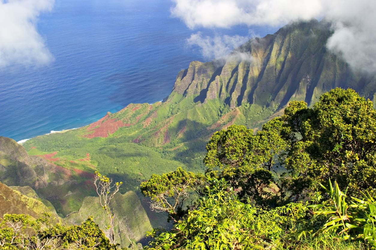
Koke'e State Park, Kauai
The Koke'e State Park is located inward from the Na Pali Coast on Kauai’s west side. The park’s main attractions are the native plants, birds and beautiful scenic views. Situated on a plateau of 3,200 to 4,200 feet (975 to 1,280 m), it is quite a bit colder here than on the beaches. The temperature can get as low as 45 degrees F (7 C) in January and is around 68 degrees F (20 C) in July. The annual rainfall is 70 inches (1778 mm). It rains the most from October to May.
The entrance fee to Koke'e State Park is $5 per person (age 4+) for non-residents. It is free for Hawaii residents with ID. The parking fee within the state park is $10 per vehicle for non-residents (free for Hawaii residents with ID).
Koke'e State Park offers tent camping opportunities with minimally developed campsites, but a camping permit is required. The cost is $30 per night per campsite for non-residents. For Hawaii residents, the fee is $20 per night per campsite. Campsites can be booked up to 90 days in advance at https://dlnr.hawaii.gov/dsp/parks/kauai/kokee-state-park/
If you’d like more comforts, there are rustic cabins available at the Koke'e Lodge. Keep in mind though that these are cabins in the mountains, located above 3,000 feet (900 m). This means temperatures can be around 50-80 F (10-27 C) in the summer and 40-70 F (4-21 C) in the winter with occasional cold snaps! High quality firewood is available for purchase, with the only heat source for the cabins being the wood burning stove.
More info about the Koke'e Cabins is available at https://www.akamaihawaiiproperties.com/west-kauai-lodging-title
Overview of 18 Hiking trails at Koke'e State Park:
- Alakai Swamp Trail – Length: 3.5 miles (5.6 km). It leads through a native wet forest to the rim of Wainiha Pali with sweeping view of Kauai’s north shore. It’s a good trail for bird watching. It is often wet, slippery and muddy. Rated difficult. Trailhead: Mohihi Road (2.75 miles in from Koke'e Road)
- Awa'awapuhi Trail – Length: 3.1 miles (5 km). The trail features mesic and dryland native plants and great views into the Nualolo and Awaawapuhi valleys. Rated difficult. Trailhead: Near mile marker 17 along Koke'e Road.
- Pu'u ka Ohelo / Berry Flat Trail – Length: 0.6 miles (1 km). This trail leads through a mix of planted alien and native forests, including redwood and sugi groves and a koaohia forest. Rated easy. Trailhead: Mohiki Road.
- Black Pipe Trail – Length: 0.5 miles (0.8 km). This trail is an alternate access to the Canyon Trail. Native iliau and hibiscus can be seen here. Rated easy to moderate. Trailhead: Connects Canyon Trail and Halemanu Road.
- Canyon Trail – Length: 1.8 miles (2.9 km). This is a popular scenic trail with great views of the Waimea and Poomau canyons. The trail follows the rim of Waimea Canyon and crosses Kokee Stream. Rated moderate. Trailhead: Pu' Hinahina Lookout on Halemanu Road.
- Cliff Trail – Length: 0.1 miles (0.16 km). This is a spur trail leading to a viewpoint of Waimea Canyon. Feral goats can often be seen on the canyon walls. Rated easy. Trailhead: Halemanu Road at entry to Koke'e State Park.
- Ditch Trail – Length: 3.5 miles (5.6 km). The trail was developed to construct and maintain the Koke'e Ditch. It features views of the surrounding forest and Poomau Stream. Rated difficult. Trailhead: Off Mohihi Road.
- Faye Trail – Length: 0.1 miles (0.16 km). This is a short trail that accesses other trails in the Halemanu area. Rated easy. Trailhead: Faye Road.
- Halemanu-Koke'e Trail – Length: 1.2 miles (1.9 km). Trail goes over the ridge from Halemanu valley to the Koke'e Camp area and ends at Camp Sloggett off Mohihi road. Views of native trees. Rated moderate. Trailhead: Pu'u Hinahina Lookout or Halemanu Road.
- Iliau Nature Loop – Length: 0.3 miles (0.5 km). This is an easy roadside trail that leads through dry shrubland. It features sweeping views of Waimea Canyon and Wai'alae Canyon. Rated easy. Trailhead: Between mile markers 8-9 on Hwy. 550.
- Kaluapuhi Trail – Length: 1.6 miles (2.6 km). This trail leads through an ohia montane mesic forest. It is a good bird watching trail. Rated easy. Trailhead: Just past Kalalau Lookout.
- Kukui Trail – Length: 2.5 miles (4.0 km). This is a scenic, but steep trail into Waimea Canyon. It has an elevation drop of 2,000 feet (610 m). Rated difficult. Trailhead: Begins from the Iliau Nature Loop, which is between mile markers 8-9 on Hwy. 550.
- Kumuwela Trail – Length: 1 mile (1.6 km). More of a hunter's trail that ends at Kumuwela Road and lookout. To the left of the lookout is the end of the Canyon Trail. It is a good bird watching trail. Rated moderate. Trailhead: Near end of Waineke Road.
- Nature Trail – Length: 0.2 miles (0.3 km). This is a good beginner’s trail. It is a loop trail with native forest plants and identification signs. Learn about the forest before going on longer hikes. Rated easy. Trailhead: Behind Koke'e Museum.
- Nualolo Trail – Length: 3.8 miles (6.1 km). Trail drops 1,400 feet in first mile. Leads through a koaohia montane mesic forest and an aalii lowland dry shrubland. Trail can be open and hot. Bring plenty of water. Views of Nu'alolo Valley. Rated difficult. Trailhead: Begins near Park Headquarters.
- Pihea Trail – Length: 3.8 miles (6.1 km). This is a scenic nature trail along the rim of Kalalau Valley, leading through an ohia montane wet forest. Slippery, muddy trail that can be dangerous. Good bird watching and views of Kalalau Valley before the trail goes into forest and boardwalk to Alakai. Rated difficult. Trailhead: Pu'u o Kila Lookout at the end of Koke'e Road.
- Waininiua Trail – Length: 0.6 miles (1 km). Forest trail that is a shortcut to other trails. Ends at Kumuwela Road. This is a good trail to see a relatively intact koaohia montane mesic forest. Rated easy. Trailhead: Waineke Road.
- Water Tank Trail – Length: 1.0 mile (1.6 km). This trail leads through a native koaohia forest. Connects Pu'u ka Ohelo Trail and Koke'e Road. Rated easy. Trailhead: Koke'e Discovery Center.
Key Features
Reviews
Reviews and Ratings
Visitor rating
1 rated review
Been here? Share your experience
Visitor experiences
Newest firstLyn
Feb 23, 2010
Map
Location, Parking and Directions
Koke'e State Park is located in the uplands of west Kauai, north of Waimea Canyon State Park and above the town of Waimea. The main road continues through Waimea Canyon toward Koke'e, Kalalau Lookout and Pu'u O Kila Lookout.
Photos
Koke'e State Park Photos
Photos of Koke'e State Park show upland forest, canyon and valley viewpoints, hiking trails, Kalalau Lookout, Pu'u O Kila Lookout, native plants and west Kauai mountain scenery.