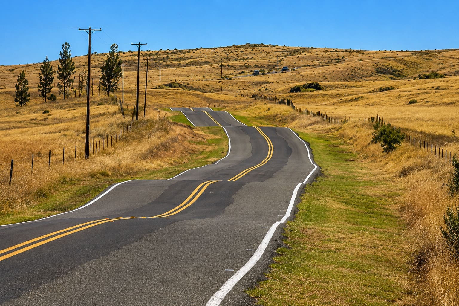
Saddle Road, Big Island
Buckle up! Slicing across the Big Island from east to west, through a high valley or “saddle” between the mountains of Mauna Kea and Mauna Loa, Saddle Road (also known as Route 200) is 54 miles (87 km) of pure adventure. Along the way, you'll pass dried lava flows, rolling pastureland, desert- and moonlike fields, lush rainforests and trailheads that lead to several hiking trails. Also along the route are roads leading to the mountaintops of Mauna Kea and Mauna Loa, as well as the largest military training reserve in Hawaii and the Bradshaw Army Airfield.
Saddle Road cuts through some of the best scenery on the Big Island. In the past, many car rental companies used to forbid use of their cars on Saddle Road, but now most allow it. For a long time, the road was considered the most dangerous in the state because it had many rough areas and marginally maintained pavement. Today, many sections of the road have been improved, but some rather dangerous spots remain. However, it is no worse than many other roads on the island and it is recommended to drive slowly and with caution. The area is remote and there are no facilities along the way, so if your car breaks down or you run out of gas, you have to walk a long way for help.
Saddle Road got its name from the stretch of road that passes between the Mauna Loa and Mauna Kea volcanoes. This “saddle” area is marked by small crosses to commemorate the people who have died while traversing the road and perhaps to remind drivers to take extra caution. Heavy mist is common in this area, so before setting out, make sure there's enough visibility. Also, there are many long, flat stretches and it's easy to become “road hypnotized” or get “lead foot,” so be careful.
The highest point on the road is at 6,632 feet (2,021 m). People have described this area as resembling a moonlike landscape, with long stretches of bare lava and very little vegetation.
Key Features
Reviews
Reviews and Ratings
Visitor Reviews
Read visitor comments for Saddle Road. These comments do not include star ratings, so they are not included in the average rating.
Been Here? Add your Review
Keith Brock
Tue Jan 22, 2013
Map
Location, Parking and Directions
Saddle Road, also known as Daniel K. Inouye Highway and Route 200, crosses the interior of Hawaii Island between the Hilo side and the west side of the island. It passes between Mauna Kea and Mauna Loa, with connections toward Hilo, Waimea, Kailua-Kona, Waikoloa and the Mauna Kea access road.
Photos
Saddle Road Photos
Photos of Saddle Road show high lava plains, open volcanic terrain, Mauna Kea and Mauna Loa views, long highway stretches, clouds, rain squalls and the island's interior landscape.