

Big Island District Guide
Big Island of Hawaii Districts
Explore Big Island districts including Hamakua, Hilo, Puna, Ka'u, Kona and Kohala, with region-by-region notes on geography, weather, towns and visitor highlights.
Maybe after browsing a Hawaii guidebook, newspaper or travel website, you have come across Big Island district names such as Hamakua Coast, Puna, North Kohala, South Kohala, Kona and Ka'u. These names can be confusing at first, especially if you are trying to understand where each region is located and what makes it different.
The Big Island is the largest island in the Hawaiian chain, so its regions cover a wide range of landscapes, climates and visitor experiences. Instead of simply referring to the north, south, east and west sides, locals and guidebooks often use district names that reflect the island's geography, history and land divisions.
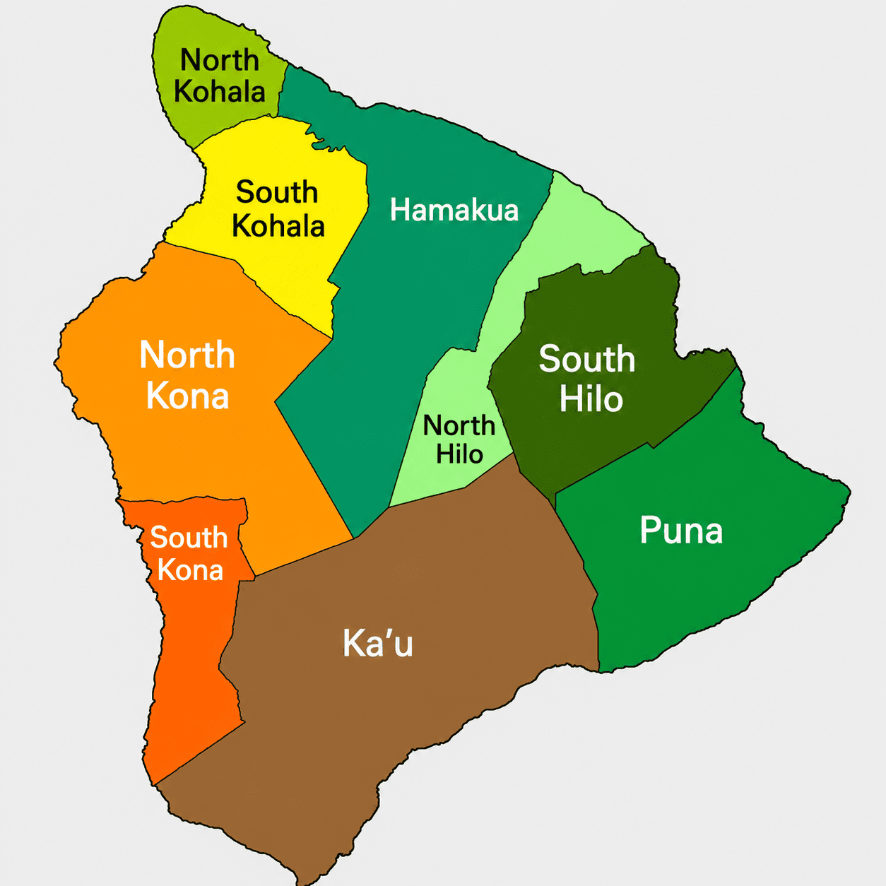
The map below gives you a helpful overview of the Big Island's main districts. Once you understand the basic layout, it becomes much easier to place hotels, beaches, scenic drives, historic sites and activities within the right part of the island.


Hamakua Coast
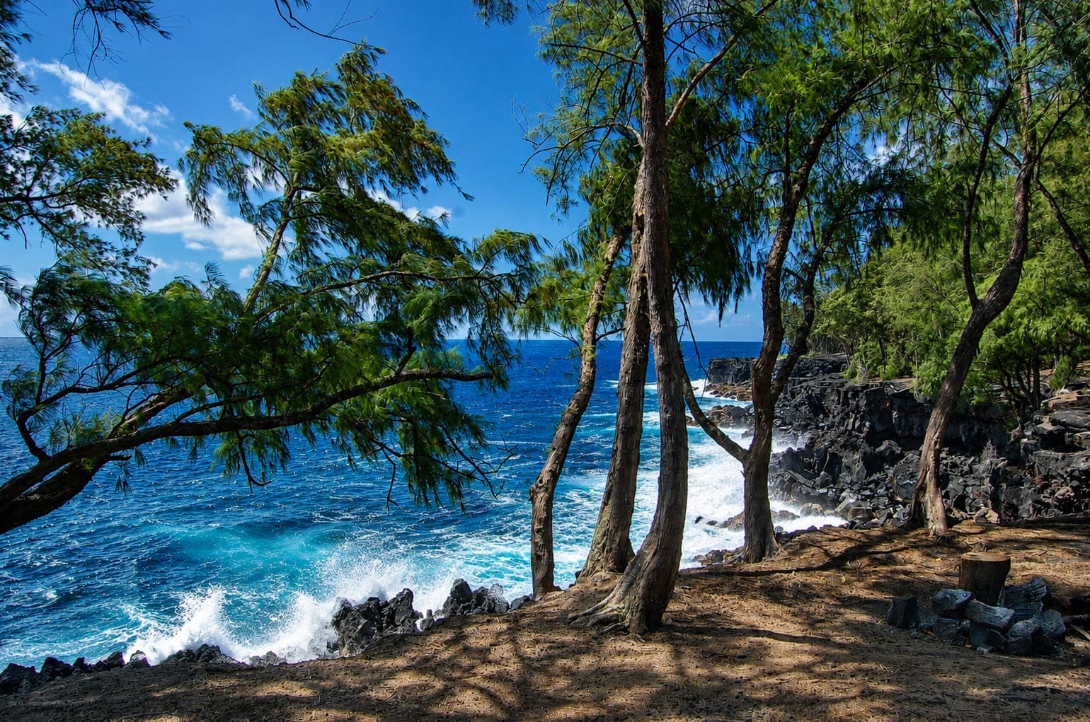
The Hamakua district follows the Big Island's northeastern shore and includes about 50 miles of rugged coastline. This windward region receives more rain than the leeward west side, which helps create its green cliffs, deep valleys and lush scenery.
Popular places in and near this region include Waipio Valley, Pololu Valley and scenic coastal viewpoints. The shoreline is mostly lava rock rather than sandy beach, and the landscape feels dramatic, rural and deeply green.
Hilo District
The Hilo district sits on the island's east side around Hilo, the largest town on the Big Island. This area is known for rainfall, tropical greenery, botanical gardens, waterfalls, museums, beach parks and a more local town atmosphere.
Hilo receives far more rain than the Kona side, which helps create its lush setting. Nearby sights such as Rainbow Falls and east-side gardens make this district a good base for visitors who want greenery, waterfalls and access to the windward side.
Puna
The Puna district stretches across the Big Island's southeast side. This region has a strong volcanic identity, with lava rock coastlines, black sand areas, geothermal features, rainforest pockets and communities shaped by Kilauea's activity.
Puna includes places such as Pahoa, Kalapana and coastal lava landscapes. Some older visitor spots have changed because of volcanic activity, so travelers should always check current access and safety information before planning a drive through the district.
Ka'u
Ka'u is the southernmost district on the Big Island and one of its most spacious regions. It includes rural landscapes, lava fields, coffee country, coastal cliffs and much of Hawaii Volcanoes National Park.
Visitors often associate Ka'u with Punaluu Black Sand Beach, Papakolea Green Sand Beach and the long drive between Volcano and South Kona. The district feels remote, open and less developed than the main resort areas.
South Kona
South Kona lies along the island's southwest coast. The word Kona refers to the leeward, or dry, side of an island, and this region has a sunny climate that supports coffee farms, coastal parks and historic sites.
Popular places in South Kona include Puuhonua o Honaunau National Historical Park, Kealakekua Bay and many small family coffee farms. This district works well for visitors interested in Hawaiian history, snorkeling, coffee country and scenic coastal drives.
North Kona
North Kona covers the west side around Kailua-Kona, one of the island's main visitor hubs. This district includes cultural sites, beaches, harbor areas, shops, restaurants, vacation rentals and many ocean activities.
North Kona and South Kohala are the areas where many Big Island visitors stay because they offer more sunshine, easier beach access and a wide range of accommodations. The Ironman World Championship also takes place in Kailua-Kona each year.
South Kohala
South Kohala is located on the island's northwest coast and includes some of the Big Island's driest and sunniest resort areas. The coastline is known for white-sand beaches, lava fields, golf courses, luxury resorts and clear blue water.
Popular places in this district include Hapuna Beach, Mauna Kea Beach, Puukohola Heiau and the upcountry town of Waimea. South Kohala receives much less rainfall than the windward side and has a noticeably dry, open landscape.
North Kohala
North Kohala forms the northern tip of the Big Island. This district has historic sites, rural towns, windswept coastline, green pastures and viewpoints toward the island's oldest volcanic landscapes.
Popular places include Lapakahi State Historical Park, Mo'okini Heiau and sites connected to King Kamehameha I. The region feels quieter than Kona and South Kohala, with a mix of coastal history, paniolo country and scenic backroads.
How to Use the Districts When Planning
Understanding the Big Island districts helps with trip planning because distances can be longer than they look on a map. Hilo, Kona, Kohala, Volcano, Puna and Ka'u each offer a different experience, and driving between regions can take time.
For sunny resort weather and beaches, visitors often focus on North Kona and South Kohala. For waterfalls, gardens and lush scenery, Hilo and Hamakua are good choices. For volcanoes, lava landscapes and dramatic geology, Ka'u and Puna offer some of the island's most memorable terrain.
Frequently Asked Questions
How many districts are on the Big Island?
The Big Island is commonly described by districts such as Hamakua, Hilo, Puna, Ka'u, South Kona, North Kona, South Kohala and North Kohala. Each region has its own geography, weather patterns and visitor highlights.
Which Big Island districts are best for visitors?
North Kona and South Kohala are popular for sunny weather, beaches and accommodations. Hilo and Hamakua are best for waterfalls and lush scenery, while Ka'u and Puna are known for volcanic landscapes.
Which district is Kailua-Kona in?
Kailua-Kona is in the North Kona district on the west side of the Big Island. This area is one of the island's main visitor hubs and offers beaches, dining, shopping, historic sites and ocean activities.
Which Big Island district has the driest weather?
South Kohala is one of the driest areas on the Big Island, especially along the resort coast. North Kona is also generally sunny and dry compared with the wetter Hilo and Hamakua districts.
Where is Hawaii Volcanoes National Park located?
Hawaii Volcanoes National Park is mainly in the southern part of the island near the Ka'u and Puna regions. It includes volcanic landscapes, crater views, lava fields and high-elevation rainforest areas.