


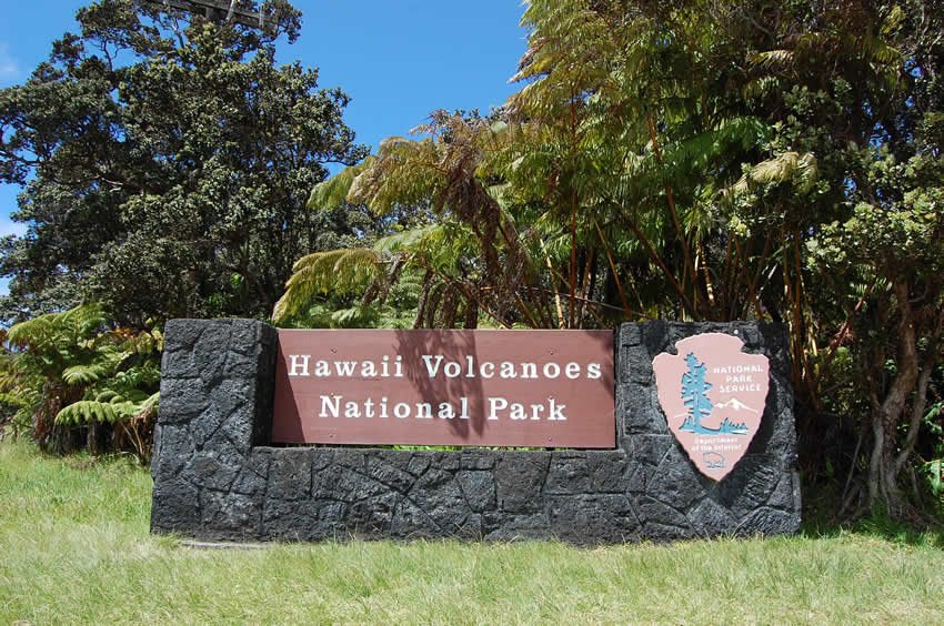
Hawaii Volcanoes National Park
Hawaii Volcanoes National Park is the most popular attraction in the state, encompassing over 377 square miles of volcanic terrain, rainforests, craters, lava tubes, and historic sites. Visitors come to witness dramatic volcanic landscapes, hike scenic trails, view lava flows (when active), and learn about the geological and cultural significance of Mauna Loa and Kilauea volcanoes.
Hawaii Volcanoes National Park, Big Island
Look into the mouth of one of the world's most active volcanoes at the Hawaii Volcanoes National Park. Here you can see active lava flows up-close, which is the main reason why most people come here. Not many other places in the world provide this kind of opportunity. The park encompasses 377 square miles (976 sq. km) and is the number one visitor attraction in the entire state of Hawaii, welcoming about 2.5 million visitors per year. In 1980, the park was named an International Biosphere Reserve by UNESCO, and in 1982, it was given World Heritage status. There are a number of attractions within the park, and it can easily take a few days to visit the most popular ones. Here is an overview of what there is to see and do:
The 13,679-foot (4169 m) summit of Mauna Loa is located at the upper end of the park. It is the most massive mountain in the world, containing 19,000 cubic miles (79.195 cubic km) of solid lava rock and weighing more than California's entire Sierra Nevada mountain range (to give you an example of how massive it is). Mauna Loa is 60 miles (97 km) long and 30 miles (48 km) wide, with its large Moku'aweoweo Caldera located at the summit.
Even though its grandeur is simply spectacular and unmatched, Mauna Loa is the least visited part at Hawaii Volcanoes National Park. The reason is because it's only accessible via a 17-mile (27 km) hike (it's about a 3-4 DAY hike if you're in good condition). The trail is steep, the air is thin and the temperature hovers around freezing, even in the summer months, plus snow in the winter. Those who make it are treated to views of Moku'aweoweo Caldera, which is 3 miles (4.8 km) long, 1.5 miles (2.4 km) wide and surrounded by 600-foot (183 m) vertical walls.
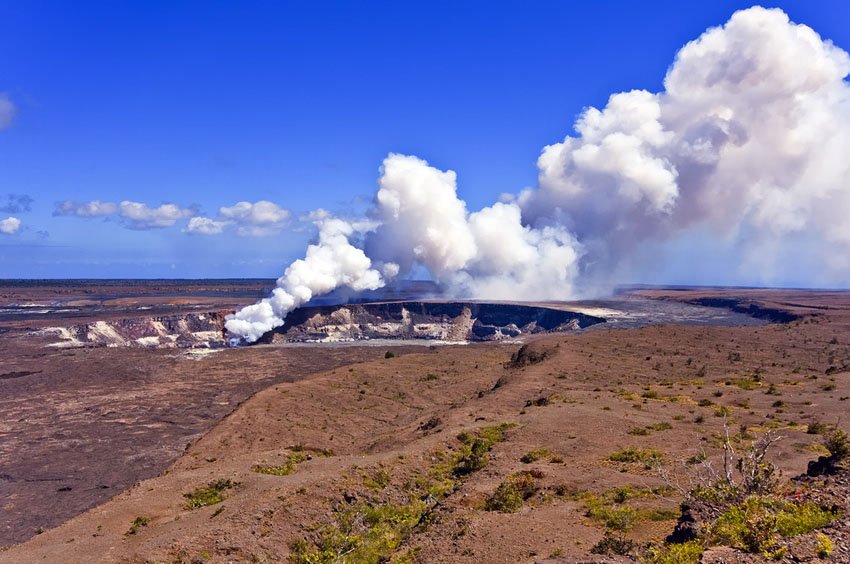
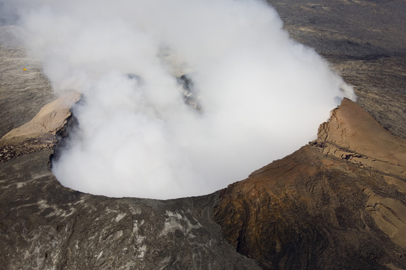
The central point at Hawaii Volcanoes National Park is Kilauea Caldera, (also known as Kilauea Crater), which is almost 3 miles (4.8 km) across, 400 feet (122 m) deep and surrounded by the 11-mile (18 km) long Crater Rim Drive. Many attractions are located along this road, such as sulfur springs, steam vents and gaping fault lines, and most visitors stick to this area, so it can be busy with tour buses. The Kilauea Visitors Center is also located here, where you can pick up park maps and camping permits and learn more about the Big Island's geology and volcanic history.
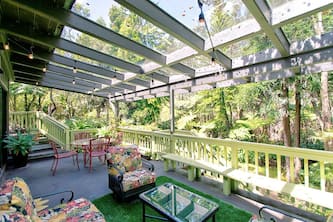
Located near the Visitors Center is Volcano House, the oldest hotel in Hawaii (today's building dates back to the 1940s, but the original structure which is now gone was built in 1846 on the same site). It has housed Hawaii's royalty as well as other famous personalities, such as Mark Twain and Franklin Roosevelt in the past and is definitely worth a visit.
Also located on Crater Rim Drive is the Jaggar Museum, where you can learn about the past and present volcanic activity in the park. The museum features a multi-media display including photos, maps, paintings and video presentations (Open daily 8:30 am to 7:30 pm, free admission). It's a good place to visit before exploring the rest of the park because it gives a nice overview.
Located nearby is Halema'uma'u Crater. There is a 0.25-mile (400 m) long cinder trail that leads to the crater overlook. After an explosion in 1942, the crater crusted over, and up until today leaks sulfur dioxide (so people with respiratory conditions should avoid this area).
The Ka'u Desert in the southwestern area of the park is a large expanse of semi-arid lava plain, interspersed by a few plants and bushes. There are a few hiking trails in this desolate area, however, they are quite challenging.
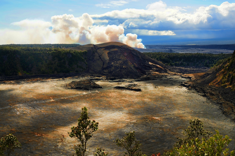
An easier and more interesting walk is the half-mile Devastation Trail, a paved path across a cinder field surrounded by dead tree trunks. It is one of the most photographed areas in the park. The area was swallowed by lava flows generated by an eruption of Kilauea Iki in 1959. Back then, fountains of lava shot 1,900 feet (580 m) into the air, and this area, which was once home to an ohia forest, was claimed. But now the vegetation has slowly made a comeback, which makes for a nice sight.
Another popular area attraction is the Thurston Lava Tube (also known as Nahuku), a natural tunnel with ferns at the entrance and exit. As you approach the lava tube, you walk through a lush fern forest. The scenery is almost magical and vibrant green colors and singing birds are everywhere. The walk through the tube itself takes about 10 minutes. The Kilauea Iki Trail begins at the Thurston parking lot (or alternatively at the Kilauea Iki Overlook). It's a popular, beautiful and easy 4-mile hike, which takes you across the floor of Kilauea Iki Crater, which was still a glowing hot lava lake as recently as 1959.
From the Crater Rim Drive, the Chain of Craters Road leads down all the way to the coast. The road once connected the park with Kalapana village, but a lava flow in 1995 flowed over the road and this is as far as one can drive it today (just past the Holei Sea Arch). The 20 miles (32 km) down to the coast are a very scenic drive (it takes about 30 minutes) and there are many lookout points along the way, offering views of ohia forests and the following immense littoral plain.
As you almost reach the coast, there is a roadside marker indicating the way to the Puna Coast Trail. Across the road from here is the trail leading to the Pu'u Loa Petroglyph Field. It takes a little less than an hour to reach the rock carvings. The trail leads across solid lava and you'll come across many interesting lava formations and flow patterns.
Once you reach the petryglyph field, which is about the size of a soccer field, you'll see a wooden walkway surrounding it, which was built to protect the rock drawings, which are estimated to be around 28,000. Some of the drawings depict men, others are circles with a hole in the middle. Pu'u Loa means “Long Hill” or “Long Life” in Hawaiian. In the past, fathers would come here to place a part of their newborns' umbilical cords into the small holes as offerings to the gods in hope that they would grant long life to their children. The petroglyph field is a sacred area and powerful spot up until today.
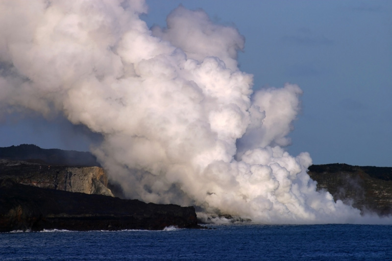
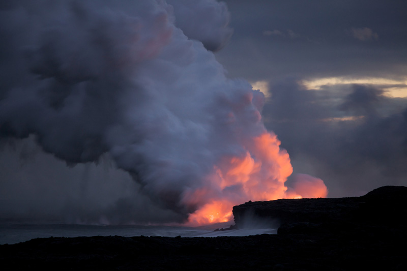
The lower end of the Chain of Craters Road is breathtaking. The jet black sea cliffs covered by green vegetation make for an amazing contrast to the deep blue ocean. In the distance, you can see steam rising into the air where the lava flows into the ocean. At the end of the road is a hut staffed by park rangers who provide information about the area. If you plan to hike towards the lava flow, speak to the rangers before venturing out. They can provide helpful tips and can warn you of the dangers.
The hike is more than 3 miles (4.8 km) one-way and there is no marked trail. It takes about 3-4 hours to get there and back. Sturdy shoes are a must because you'll have to traverse over rough and spiny lava rocks. If you plan to go later in the day to see the lava flow in the dark, it's important to bring your own flashlight. Also, bring plenty of water because the area is hot and there is no shade. Avoid walking too close to the water's edge because the lava rocks are not stable and can break off, so you could find yourself floating in the ocean with no way to get out. Also keep in mind that there are days when the lava flow is weaker, so you may not be able to see much, and then it may not be worth the effort.
Key Features of Hawaii Volcanoes National Park
- Kilauea Caldera and Visitor Center: Active volcanic crater with surrounding steam vents and exhibits on park geology
- Mauna Loa summit: World's most massive mountain, accessible via a multiday trek for experienced hikers
- Chain of Craters Road: 20-mile scenic drive through craters, lava fields, and sea cliffs
- Devastation Trail and Thurston Lava Tube: Short walks showcasing eruption aftermath and an ancient lava cave
- Pu'u Loa Petroglyphs: Sacred site with over 23,000 ancient carvings etched into lava rock
- World Heritage Site: Recognized by UNESCO for both natural and cultural importance


Frequently Asked Questions
Can I see active lava flows?
Sometimes. Lava visibility varies depending on volcanic activity. Check park updates before visiting to confirm if lava is flowing and accessible.
How do I get to the park?
The park is located 30 miles southwest of Hilo and 96 miles southeast of Kailua-Kona, accessible via Highway 11.
What are the park hours?
Hawai'i Volcanoes National Park is open 24 hours a day, year-round. The Kilauea Visitor Center is open daily from 9 AM to 5 PM.
Are there good hiking trails?
Yes. Popular hikes include the Kilauea Iki Trail, Devastation Trail, Pu'u Loa Petroglyph Trail, and summit treks for experienced hikers.
Is the volcano dangerous?
Volcanic areas can pose risks. Stay on marked trails, heed ranger warnings, and avoid unstable lava benches and sulfur vents.