Hakalau Bay, Big Island
Located on the Big Island’s eastern shore, about 13 miles (21 km) north of Hilo, Hakalau Bay is mainly a place for photos and shoreline views rather than swimming or snorkeling. The small bay has deep offshore waters, and dangerous water conditions develop during times of high surf.
The ocean bottom drops off quickly here, and rip currents often run from the bay into the open ocean. However, the bay is sometimes used by surfers. At the head of the bay, Hakalau Stream flows into the ocean, so the inshore waters are always murky. The beach is composed of black sand and fine pebbles.
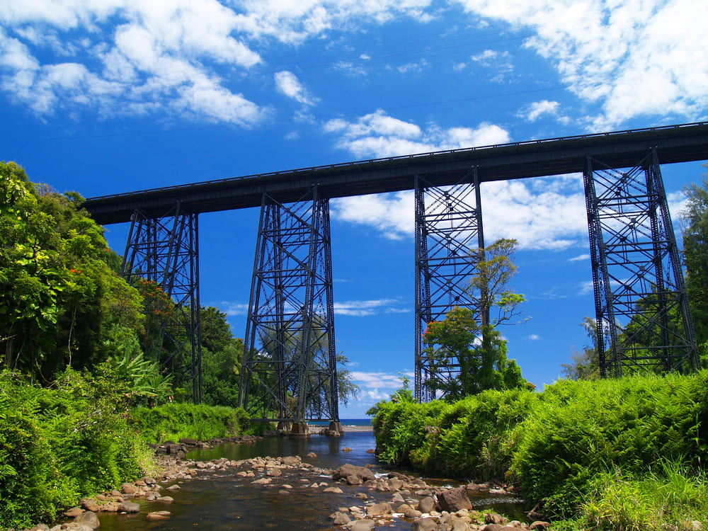
The town of Hakalau was once home to a thriving sugar industry and an important stop for local transport. Remnants of its sugar-era past can still be seen in the old railroad bridge that leads to the bay and the long-defunct plantation towers you can see from the road. Also located on the shoreline are the ruins of Hakalau Mill, which was destroyed in the tsunami of 1946.
If you’d rather stay out of the water, you can check out the nearby Hakalau Forest National Wildlife Refuge. This 33,000-acre (134 sq. km) area is home to a large collection of native flora and fauna. Some are rare and can only be found here. The refuge was also the first national wildlife refuge in the U.S. established specifically for the protection of forest birds.
Key Features
Beach Activities
Activities
Beach Facilities
Facilities
Reviews
Reviews and Ratings
Visitor Reviews
Read visitor comments for Hakalau Bay. These comments do not include star ratings, so they are not included in the average rating.
Been Here? Add your Review
Lucky
Sun Jan 01, 2012
Map
Location, Parking and Directions
Hakalau Bay is located off Hawaii Belt Road, also known as Mamalahoa Highway, near Pepeekeo on Hawaii Island's east coast. From Highway 19, turn toward the ocean at the Hakalau sign and follow the road down into the gulch below the large steel trestle.
Photos
Hakalau Bay Photos
Photos show Hakalau Bay, the black-sand and pebble shoreline, Hakalau Stream, old railroad bridge, mill ruins, gulch scenery and East Hawaii coast views.