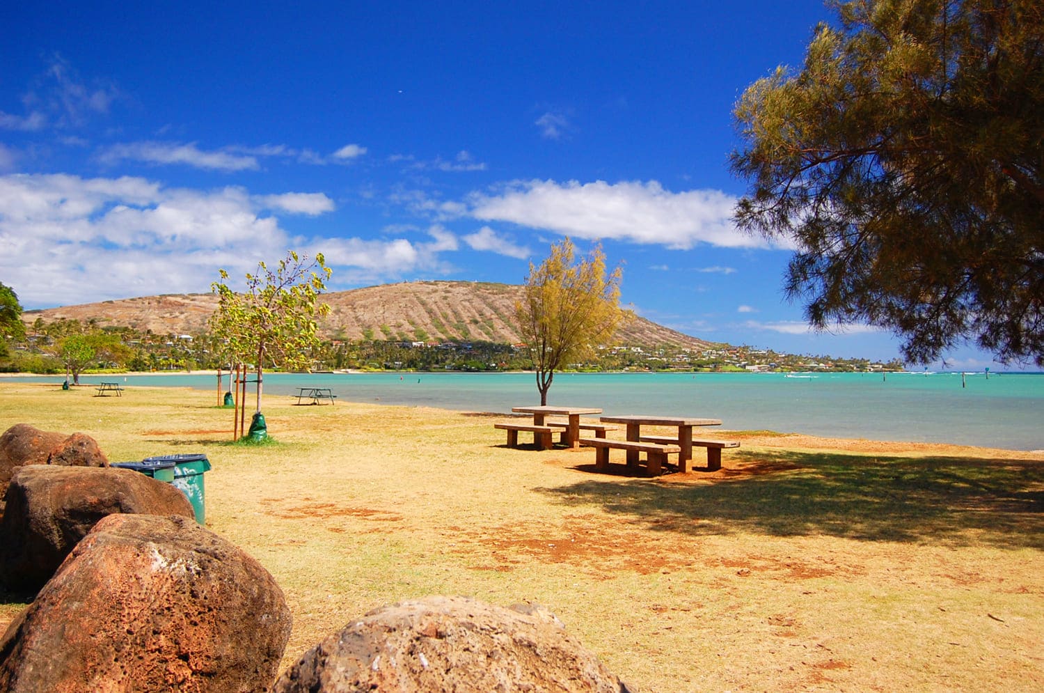
Maunalua Bay Beach Park, Oahu
Maunalua Bay, located in Hawaii Kai on Oahu's south shore, is a favorite spot for canoe paddlers, boaters, kayakers, fishers and picnickers. Swimming conditions are poor because the ocean bottom is shallow and rocky, but the bay views are nice and other ocean activities are common here. Maunalua means “two mountains” and refers to Koko Crater and Koko Head, the two peaks east of Maunalua Bay.
The beach park borders Kalanianaole Highway and was developed by Henry J. Kaiser when the Hawaii Kai Marina was built. In the past, the beach consisted of 535,000 square feet (49,703 sq. m) of coral that was dredged from the bay and pumped into low places along the existing shore. A boat channel was also dredged. After the park was completed, Kaiser donated it to the City and County of Honolulu in 1960.
The Hawaii Kai Marina was once a huge fishpond named Kuapa. At one point it covered 523 acres (2.1 sq. km), and its wall was 5,000 feet (1.5 km) long. Today, Maunalua Bay is still a busy ocean access point for paddling, boating, kayaking and fishing. There is a canoe storage building, or halau, at the west end of the park.
Key Features
Beach Activities
Activities
Beach Facilities
Facilities
Reviews
Reviews and Ratings
Visitor Reviews
Be the first to review Maunalua Bay Beach Park.
Been Here? Add your Review
Map
Location, Parking and Directions
Maunalua Bay Beach Park is located at 6505 Kalanianaole Highway in Hawaii Kai on Oahu's southeast shore. The park is near the Hawaii Kai Marina entrance and faces Maunalua Bay, with Koko Head and Koko Crater visible to the east.
Photos
Maunalua Bay Beach Park Photos
Photos of Maunalua Bay Beach Park show the Hawaii Kai waterfront, boat ramps, paddling groups, picnic areas, Koko Head views, bay water, marina entrance and southeast Oahu scenery.


Video


