La Perouse Bay, Maui
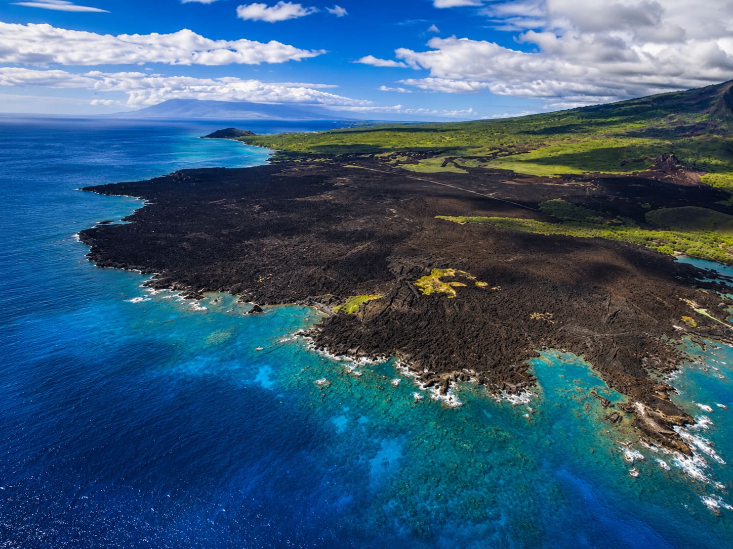
La Perouse Bay, located on Maui's south shore in the Ahihi Kinau Natural Area Reserve, has a rocky shoreline. The bay features several small coves between rocky points, and these areas are often covered with tide pools. Some coves have small sandy sections, but most have coral-rubble shoreline. The road that leads to La Perouse Bay is narrow, and the last stretch to the bay is unpaved and rough with lava rocks.
The bay is somewhat protected from strong currents, but during storms and heavy surf, the water inside the coves can become very turbulent. La Perouse Bay has a reputation as a snorkeling area, but the bay itself usually has poor visibility. The small coves along the northern side of the bay are part of a protected nature reserve, and access rules can change. Follow all posted signs and stay out of closed or restricted areas.
One nearby ocean area is Moanakala, locally known as Dumps, named after a rubbish dump that used to be located here. It is in the northern portion of the reserve, just south of Ahihi Cove. The water entry can still be rough, and the snorkeling at Dumps is not suitable for beginners because wind, chop and occasional strong currents can make conditions difficult.
When visiting this area, wear sturdy shoes because sharp lava rocks cover much of the shoreline. The stark lava fields, bright blue ocean, coral-rubble beaches and waves hitting the cliffs make this a memorable photo stop. Keep in mind that the bay is part of a protected natural area, so do not harass or approach marine life, and do not remove or damage rocks, plants or coral.
La Perouse Bay is named after French naval officer and explorer Jean-Francois de La Perouse, who reached Maui in 1786. The Hawaiian name of La Perouse Bay is Keone'o'io.
Key Features
Beach Activities
Activities
Beach Facilities
Facilities
Reviews
Reviews and Ratings
Visitor Reviews
Be the first to review La Perouse Bay.
Been Here? Add your Review
Map
Location, Parking and Directions
La Perouse Bay is located at the end of Makena Alanui Road on Maui's far south shore, beyond Makena and near Ahihi Cove and Ahihi-Kinau Natural Area Reserve. The bay marks the end of the road and the start of coastal lava trails along the dry South Maui shoreline.
Photos
La Perouse Bay Photos
Photos of La Perouse Bay show the Keone'o'io shoreline, black lava fields, tide pools, coral rubble, rough road, coastal trail, blue water, dry South Maui scenery and Haleakala lava landscape.