


Nihoa
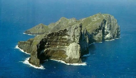
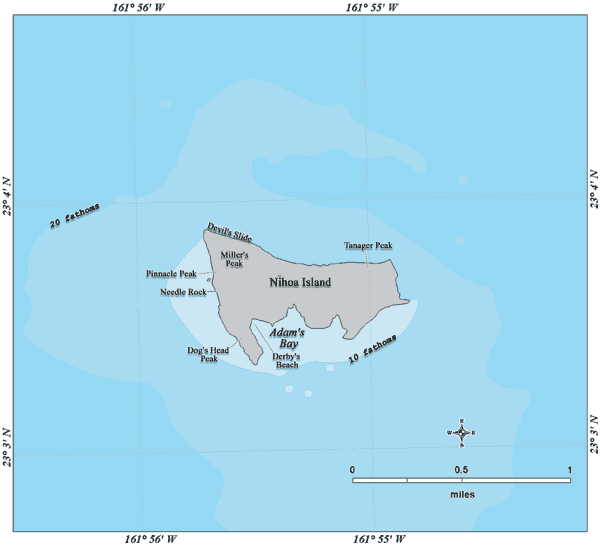
Nihoa, also known as Bird Island or Moku Manu, is the youngest of the Northwestern Hawaiian Islands; it is about 7.2 million years old. Situated about 120 miles (193 km) northwest of the island of Niihau and about 280 miles (450 km) northwest of Honolulu, Nihoa Island encompasses 0.27 square miles (0.7 km²) of land and is also the tallest of the Northwestern Hawaiian Islands, rising 903 feet (275 m). The island was once much larger, but erosion did its job so that these 900-foot cliffs are all that's left.

Nihoa got its name based on its look - "Nihoa" means "tooth" in Hawaiian. The island's volcanic peak looks like a tooth that comes out of the ocean. In fact, Nihoa has two peaks, Miller's Peak in the west (903 feet/275 m) and Tanager Peak in the east (852 feet/260 m). There are also six valleys that slope down from north to south, meeting at the south coast of the island: West Valley, West Palm Valley, Miller Valley, Middle Valley, East Palm Valley and East Valley. Other interesting features on Nihoa include Dog's Head Peak (358 feet/109 m), which is named because it looks like that, and Pinnacle Peak (626 feet/191 m), which is a volcanic dike. Albatross Plateau is the only flat area on Nihoa.


Nihoa was once settled by the early Hawaiians. Extensive prehistoric agricultural terraces and house sites have been found on the island. However, it is not known exactly how many people once lived on Nihoa. Even though large terraces were found that suggest a large number of people living there, there is only a small amount of freshwater on the island. That's why it is thought that Nihoa was only used for religious purposes.
As with almost all other Northwestern Hawaiian Islands, all visitors to Nihoa need to obtain a USFWS-issued special-use permit to go on the island. This is to prevent the introduction of alien species to the island's fragile ecosystem. In 1988, Nihoa was added to the National Register of Historic Places and became part of the Papahanaumokuakea Marine National Monument in June of 2006.