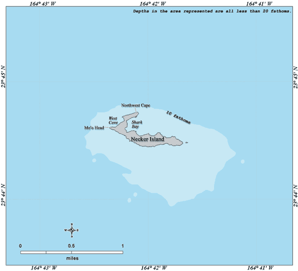


Necker Island
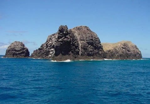
Located 155 miles (249 km) northwest of Nihoa and 430 miles (690 km) northwest of Honolulu, Necker Island (Mokumanamana) is a small (barely 41 acres), steep-sided, hook-shaped and barren volcanic island, quite unlike the tropical ideal of white-sand beaches and swaying coconut palms. Rainfall is less a little less than 25 inches a year and the only vegetation one can find here are low-growing shrubs and grasses. Necker Island is rocky and has very little soil. Its highest peak is 276 feet (84 m) and it encompasses 0.07 square miles (0.18 km²). It is one of the Northwestern Hawaiian Islands.

Probably because of its scarcity of natural supplies, few signs of any long-term habitation in the island's past have been found. However, there are 33 stone shrines on Necker Island and because of this, some anthropologists believe that Necker was a ceremonial and religious site.


It is believed that visits to Necker Island started a few hundred years after the Main Hawaiian Islands were inhabited and that habitation on Necker ended a few hundred years before European contact. The first European who visited Necker Island was French explorer Jean-François de La Pérouse, in 1786. The island is named after Jacques Necker. Because Necker Island was used by Native Hawaiians as a ceremonial and religious site in the past, the island was added to the National Register of Historic Places in 1988.
One legend from the island of Kauai, which lies to the south, tells that Necker Island was the last known refuge for the mythical "little people," the Menehune, who were chased off Kauai by the Polynesians and after that settled on Necker. They are believed to have built the stone structures there.